Ouagadougou, Burkina Faso – From July 12 to 16, 2021, GGGI in collaboration with the National Observatory for Sustainable Development (ONDD), a division within the Permanent Secretariat of the National Council for Sustainable Development (SP/CNDD), organized a training workshop on Remote Sensing and Geographic Information Systems. This training aimed to build and consolidate the capacity of key national MRV stakeholders on the processing of satellite images to produce thematic maps on land use.
The opening ceremony was chaired by the representative of the SP/CNDD, Mr. Philippe TAMINI, Director of ONDD, who stressed that “This training will help Burkina Faso strengthen its transparency framework as part of Paris Agreement. It will help us know the conditions under which the data are produced, as well the methods and tools used to process and analyze them. ”
One of the recommendations of the GGGI report entitled Development of a measuring, reporting and verification (MRV) system in Burkina Faso was to strengthen the capacity of national actors on MRV systems with a focus on data collection, analysis, management and archiving.
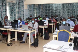
This technical workshop brought together thirty (30) technicians involved in data collection, production and analysis from the following national institutions: SP/CNDD, General Directorate of Green Economy and climate change (DGEVCC), General Directorate of Irrigation (DGAHDI), National Office of Soil (BUNASOL), the Environment and Agriculture Research Institute (INERA), The General Directorate of grazing area (DGEAP), the National statistics Institute (INSD), the General directorates of studies and sectoral statistics (DGESS) within the Ministry in charge of Agriculture (MAAHM); the Ministry in charge of Environment (MEEVC) and the Ministry in charge of livestock (MRAH).
At the end of the training, participants (i) strengthened their understanding on coordination systems and mapping projections; (ii) learned how to download satellite images captured by Sentinel2 and Landsat; (iii) learned how to visualize and process satellite images with Envi software; (iv) learned how to design thematic maps on land use with mapping software such as ArcGIS and QGIS, (v) learned how to conduct a spatio-temporal analysis of land use changes with spreadsheets. The category of land uses in Burkina Faso context covered during the training are among other gallery forest, woodland forest, shrub forest, rivers, agricultural lands.
This GGGI initiative has been fully appreciated by the participants who are eager to apply the acquired knowledges to produce land use maps for multiple purposes.